All of Seoul as an interactive 3D miniature
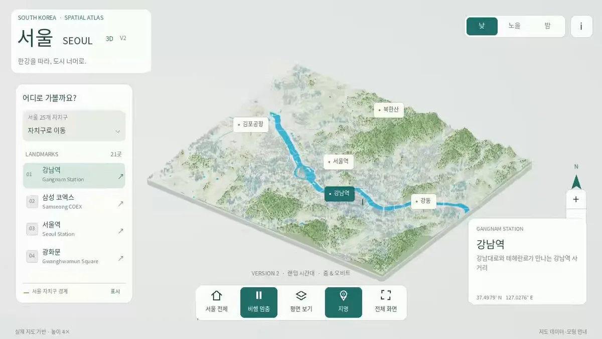
synabreu's first GPT-6 Astra project: all 25 districts of Seoul, about 267,000 buildings from real map data, day, sunset and night modes — from project start to deployment in under 44 minutes.
What it took
- Time
- 44 m
The easy version of this demo is one famous building, lovingly lit. This is the other version: all 25 districts and the surrounding area, roughly 267,000 buildings, rotate-and-zoom controls, an automated fly-through of 14 landmarks, three lighting modes and mobile touch support.
What makes it more than a pretty render is the honesty about method. The buildings come from OpenStreetMap footprints and real terrain data, simplified for performance; heights are exaggerated 4× so the city reads; landmarks are labelled as interpretive recreations, not survey-grade models. The data sources and licences are all credited.
Geography at this scale used to mean a GIS team. Here it is one person's first project on a new model, and he timed it: 43 minutes and 38 seconds from creating the project to deploying it.
Made with

synabreu
@synabreu
Hi Friends, for my first project created with GPT-6 Astra, I built the entire city of Seoul in 3D—a small revolution in digital geography! 😄 This interactive 3D miniature covers all of Seoul and its surrounding areas, and you can explore it yourself. It includes: • All 25 https://t.co/YfgnpZvZsU
2.9K likes
- likes
- 2,936
- replies
- 96
Captured when this was curated, not live. —